The basics: what are Neighborhood Greenways?
New to Alameda, Neighborhood Greenways will be residential streets where motor vehicle speeds and volumes will be lowered enough to make bicycling comfortable and safe for people of all ages and abilities.

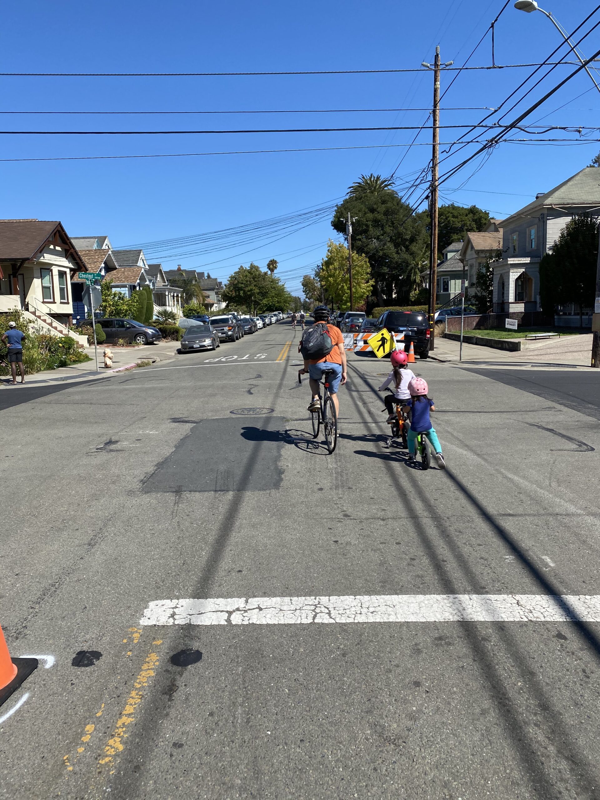
Our Slow Streets are very quick-build precursors to Neighborhood Greenways, assembled as a response to COVID in 2020. Car traffic was limited on these streets using barricades. Of course, barricades haven’t been nearly as effective as real infrastructure will be, but at times, they can give you a sense of the experience.
On these streets, travel by bike will be comfortable and stress-free. Bicyclists won’t feel the need to ‘take the lane’ and go traffic speeds; getting overtaken by cars should happen rarely if ever; families and friends feel comfortable bicycling socially, in groups or side by side; little kids can ride slowly and wobble unexpectedly as kids do, without consequence.
In a statistically significant survey conducted by our city a few years ago, 46% of Alamedans were interested in biking, but only if they could avoid interacting with car traffic. Neighborhood Greenways will make bicycling an attractive option for these people.
18 miles of Neighborhood Greenways are proposed in the city’s Active Transportation Plan (ATP), and they are critical for stitching together a connected, low-stress network in our city. Several of the Neighborhood Greenways will serve as safe north-south connectors, which anyone familiar with getting around Alameda by bike knows, is a huge problem. In this map of our 2030 Low Stress Backbone Network, the planned Neighborhood Greenways are the orange dotted lines. The ones that are oriented more or less north-south are Versailles, Chestnut, Ninth, Eighth, and Third.

What kind of car speeds and volumes should we expect on these streets, and how will this be achieved?
The ATP sets targets of vehicular travel speed of 20 mph, and average daily traffic of 1,500 vehicles or less, with less than 50 cars in the peak direction at peak hour. Measurements will be taken periodically to track motor vehicle speeds and volumes. If they are too high, additional countermeasures will be installed to control speed and volumes, until targets are achieved. The timing of these cycles is still TBD.
Sounds great! What’s the implementation plan?
The ATP calls for converting all Slow Streets (Pacific, Versailles, San Jose) to Neighborhood Greenways first, in 2024, then building the remainder in 2025. However, the city is now proposing to delay implementation. Bike Walk Alameda is urging the city to proceed without delay, because these streets are so important. Neighborhood Greenways — and the Low Stress Network they’ll stitch together — will offer thousands of Alamedans a way to be less car-dependent, to safely get around town in a way that’s healthy, inexpensive, green, and fun. They’ll offer kids independence, and return time back to parents who no longer will have to chauffeur their kids around.
Emissions from cars are by far Alameda’s largest source of greenhouse gas emissions. The more we can do to enable carbon-free transportation options, the better. Neighborhood Greenways are a key building block in Alameda’s decarbonization strategy, because without them, we aren’t going to get that 46% of Alamedans to even consider leaving their cars parked for a half mile trip to the post office.
Our city’s has done a lot of work creating and adopted visioning documents and resolutions that map out a clear path to achieving important safety, climate, and equity goals. We take that work, including plans for Neighborhood Greenways, very seriously, and urge our city leadership to do so as well. Let’s get building!

